

Hiking Routes
All the routes are of moderate difficulty, in paths, a few kilometers of dirt roads, with a greatest altitude difference of 400 m. Pine forests in combination with shrubby vegetation of arbutus, cistus, schina, heaths, sousoura, etc. they arouse the senses with colours and aromas. Streams with small waterfalls, huge and unusual stones- real sculptures of nature - remnants of Mount Athos heritage (Metochia and Watermills) equal in beauty with the panoramic view to Toroneos and Siggitikos Gulf.
Caution! During the months of September and October there are beehives due to the susoura, at the points where the paths cross with a dirt road. Also, special attention is needed during the winter months when hunting is allowed, especially in the area of Tripotamos and Bakola.
Each path below is represented by the map with trails that you can download. All the paths are passable and marked in the best possible way.
Μ1: Tripotamos- Themeli- Anigmata- Tripotamos (8,41 Km)
Μ2: Anigmata- Skiathas- Mpalemonas- Parthenon (10,05 Km)
Μ3: Tripotamos- Likamboliana-- Saint Athanasios- Parthenon (6,07 Km)
Μ4: Paradisos- demenitia- Kapsala- Parthenon (5,52 Km)
Μ5: Metochi S. Grigoriou- Mana Nerou- Parthenon (5,96 Km)
Μ6: Masoutis- Giona- Kamini- Parthenon (6,82 Km)
Μ7: Giona- Mylos (0,7 Km)
Μ8: Masoutis- Giona- Tourles (5,93 Km)
Μ9: Parthenon- Kostas (4,20 Km)
Μ10: Masoutis- Mylos- Tourles (4,11 Km)
Μ11: Masoutis- Mylos- Mbakola (4 Km)
Μ12: Masoutis- Petrara- Itamos (11,37 Km)
Μ13: Masoutis-Mbakola- Paliometochoudi- Tourles (7,14 Km)
Μ14: Fidoklissia- Paliomylos-Tsouga (5,68 Km)
Μ15: Petrara- Kostas (5,85 Km)
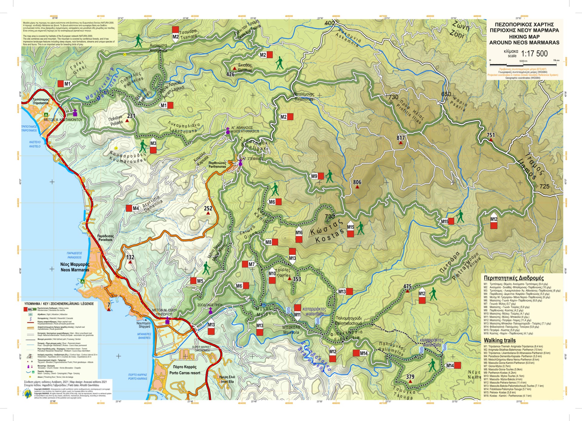
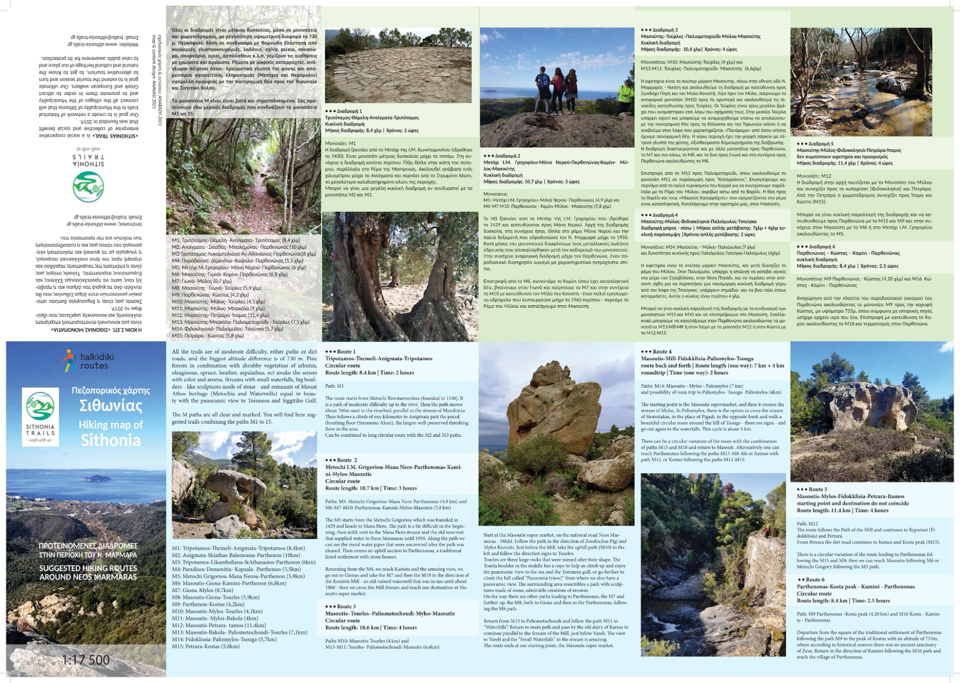
A hiker friend from the Thessaloniki Mountaineering Association was kind enough to send us the map with all the routes in gpx format, useful for all climbers.


